Serwis wymaga plików cookies do prawidłowego działania strony. Korzystanie z serwisu bez zmiany ustawień dla plików cookies oznacza, że będą one zapisywane w pamięci urządzenia. Ustawienia te można zmieniać w przeglądarce internetowej.
The best Polish website dedicated to the Greek island Crete and to a small extent of continental Greece. You will find useful information related to visiting Crete that goes beyond the offer of optional tours. On the website you will also find descriptions of the most interesting places that we visited by visiting this largest Greek island. The content complements the current news, photographs and recipes of Greek cuisine.
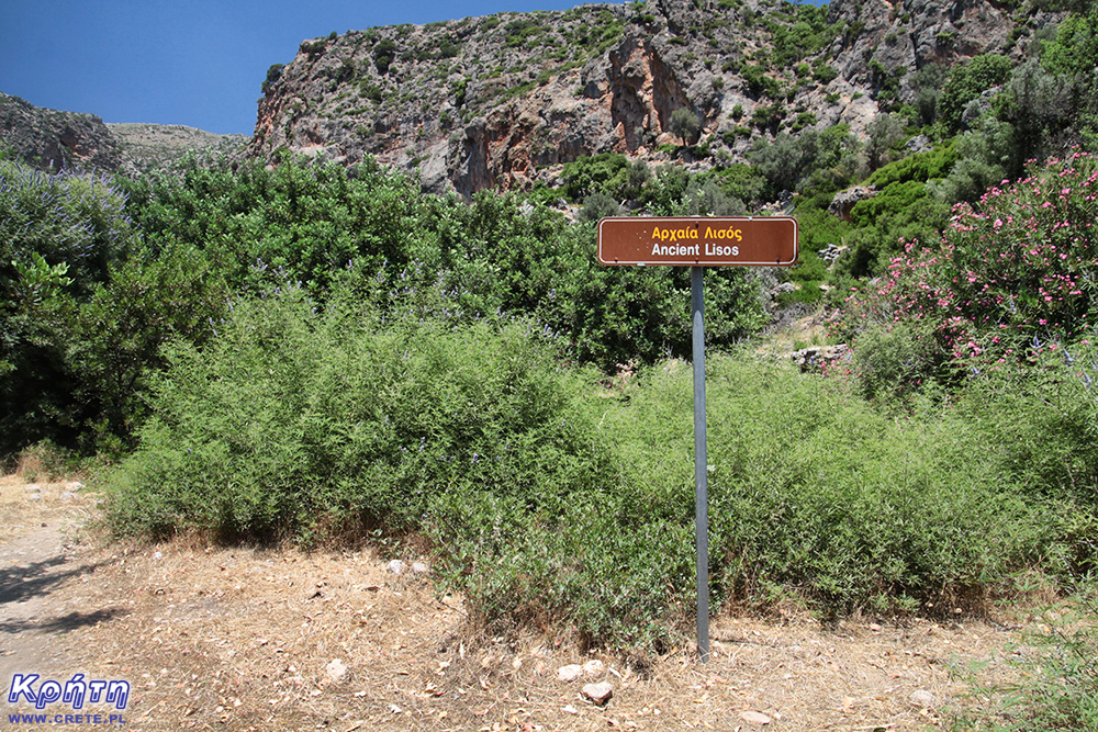
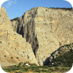
The ruins of the ancient city of Lissos (Λισσός) are located about 3.5 km from Sougia on the southern coast of Crete and about 70 km southwest of the city of Chania in the place where Agios Kirikos is currently located. Lissos is one of those places that can be reached either on foot over a part of the E4 route or a rented boat.
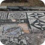
Pedestrian crossing is not a particularly easy trip, but looking at the remains of the amazing mosaic in the ancient temple of Asklepios, you forget about the scorching sun and the more difficult parts of the trail leading here.
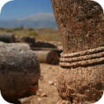
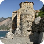
Antique Lissos
Ancient Lissos, located between Paleochora and Sougia, was the port of the Doric town of Elyros, which was located in the place of the contemporary village of Rodovani. Archaeologists date the existence of Lissos between the 4th century BC and the 9th century AD The early history of the city is not well understood. Both Lissos and 30,000-strong Elyros and its other port, Sougia, flourished during Hellenistic, Roman and Byzantine times. Saraceni, who came here from Spain, were responsible for the destruction of this place. The end of the city's existence was ultimately caused by a huge earthquake which then hit the island.
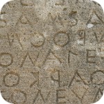
The autonomous Lissos lying on the route of merchant routes had a huge merchant fleet. Residents also based their activities on fishing. On the basis of the inscriptions and coins found, it is known that in the Hellenistic period Lissos played an important role as a member of the Orio Federation, which also included Elyros, Syia, Poikilassos, Tarra and Yrtakina.
Both Elyros and Lissos had their own coins. Those beaten in Lissos (supposedly gold) found after centuries by archaeologists on the one hand presented the image of the Greek goddess Artemis and on the other - a dolphin.
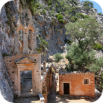
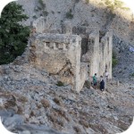
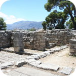
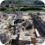
Temple of Asclepius in Lissos
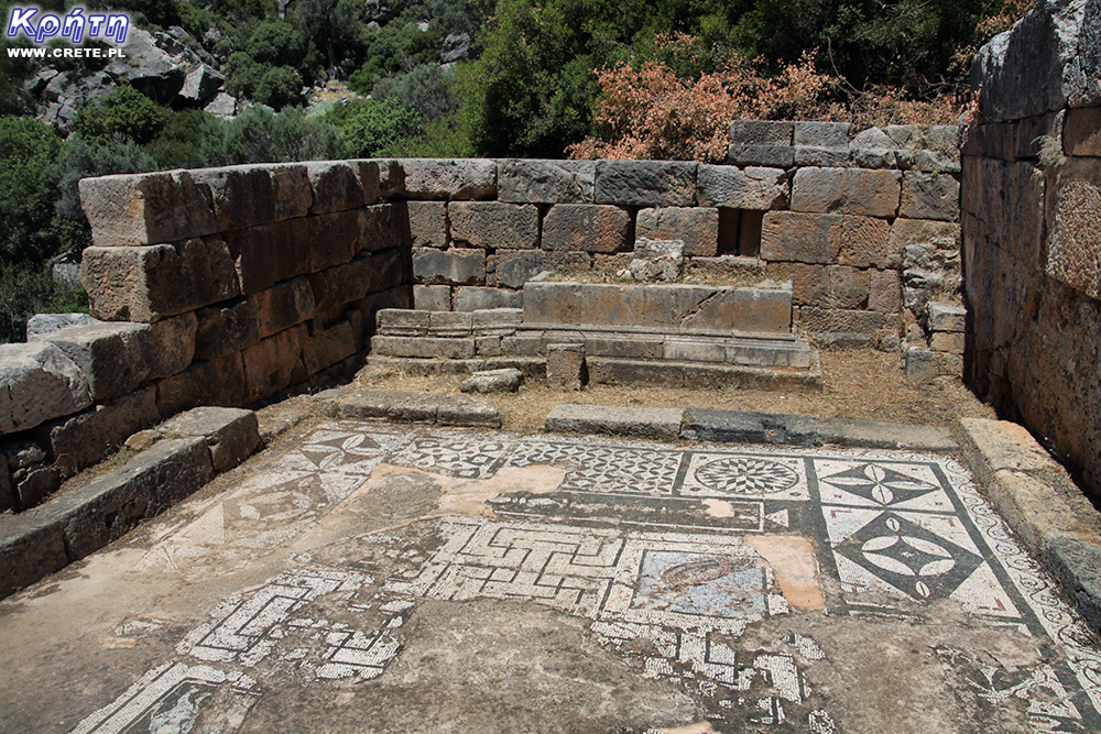
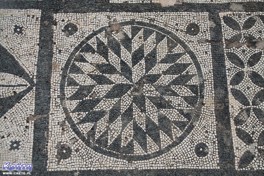
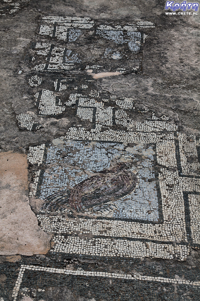
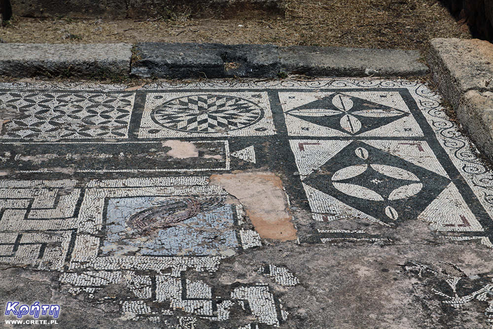
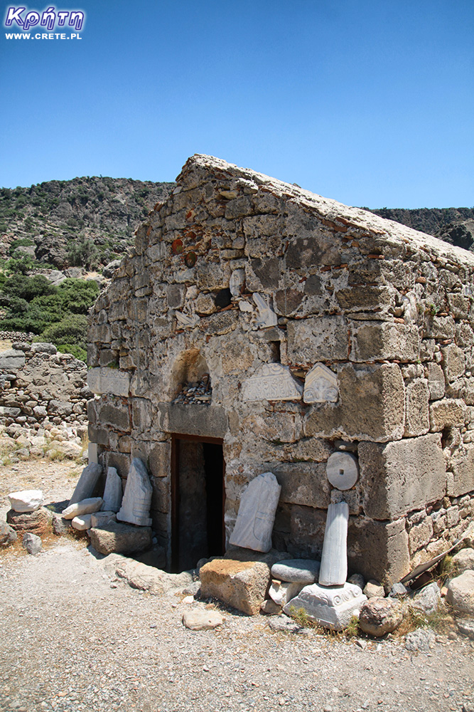
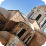
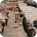
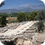
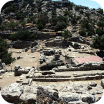
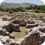
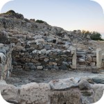
In ancient times, Lissos was a place where people from all over Crete, Greece and the North African coast came. The purpose of their journey was the Askleopiosa temple (Aesculapium) famous for its unusual water gushing from local sources. According to the message, it supposedly had a beneficial health power, which was willingly used to treat all kinds of ailments. Today, only the fragments of the walls and the enchanting Roman mosaic covering the former temple floor remain from this sanctuary. Animal and geometric motifs have survived the great earthquake and can be admired here on the spot. Fragments of the walls were partially reconstructed from the same materials that previously formed the temple. It is an extraordinary experience for every fascinated archeology, looking at the old mosaic that has not been transferred to a sterile museum. It is just for this temple to come here and admire the precision of forms and the beauty of workmanship.
Discovering Aesculapium, as is often the case in Crete, we owe to a local shepherd who was looking for water for his flock. Serious archaeological work was carried out here in the years 1957-1960. Asklepios' temple was excavated by a famous Greek archaeologist, discoverer of the Minoan palace in Zakros, Nikolas Plato. Its ruins were under great rocks, which centuries ago contributed to its destruction and at the same time have hidden its remains for hundreds of years. Around the ruins of the temple, other auxiliary objects associated with the functioning of this place in antiquity were also identified.
Basin of statues
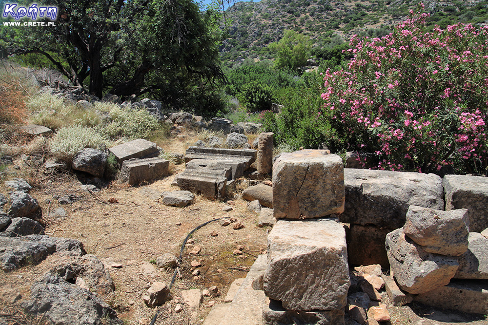
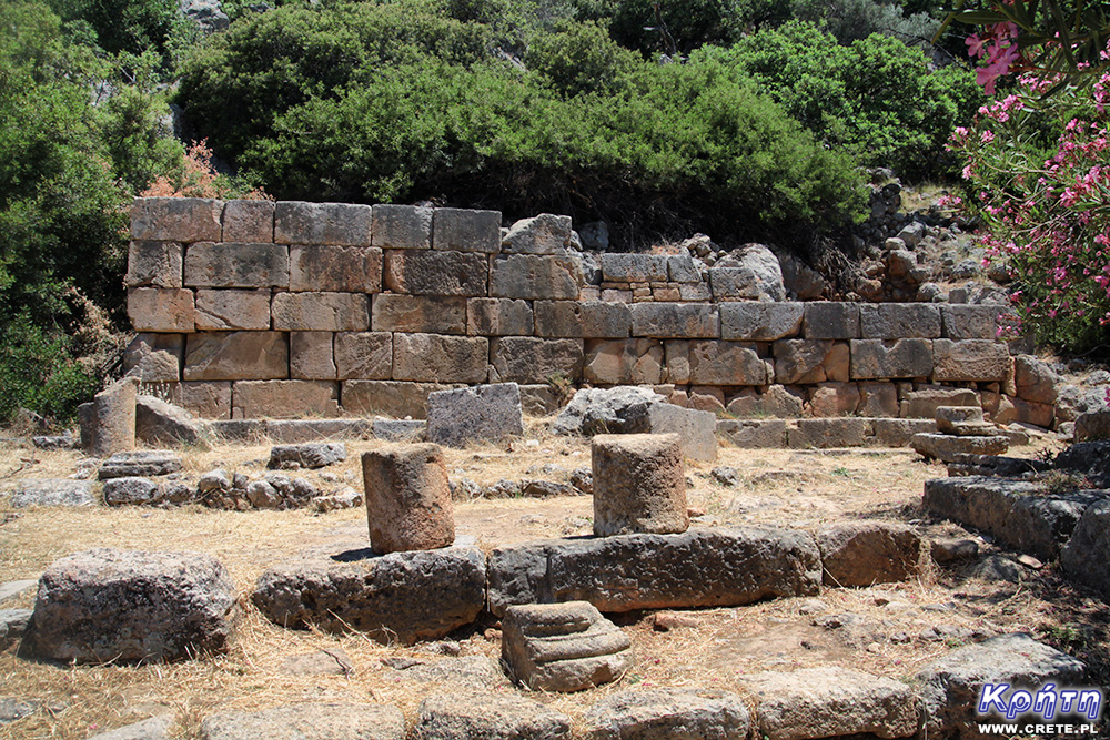
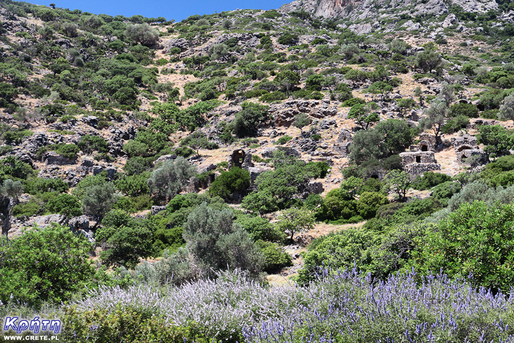
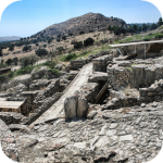
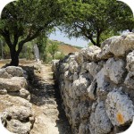
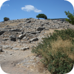
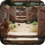
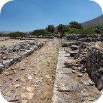
The remains of Lissos are scattered throughout the entire valley, so look carefully around. Some parts of the building are just in the surrounding bush. This is where 20 statues were found, including the famous figures of Asclepius, his daughter Hygiei, the goddess of health, and the statue of Pluto. Of course, these sculptures are not here anymore, because these valuable artefacts have been moved to the Archaeological Museum in Chania and Heraklion. These numerous finds testify to the wealth and power of the old Lissos. According to sources, only Gortyn, the Roman capital of Crete, has found a larger number of statues.
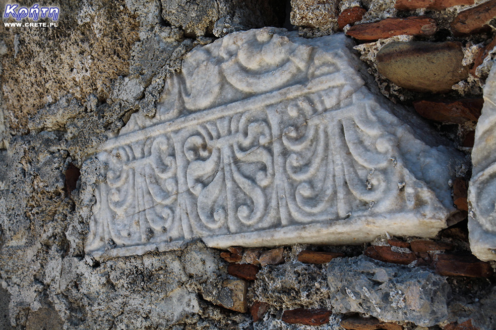
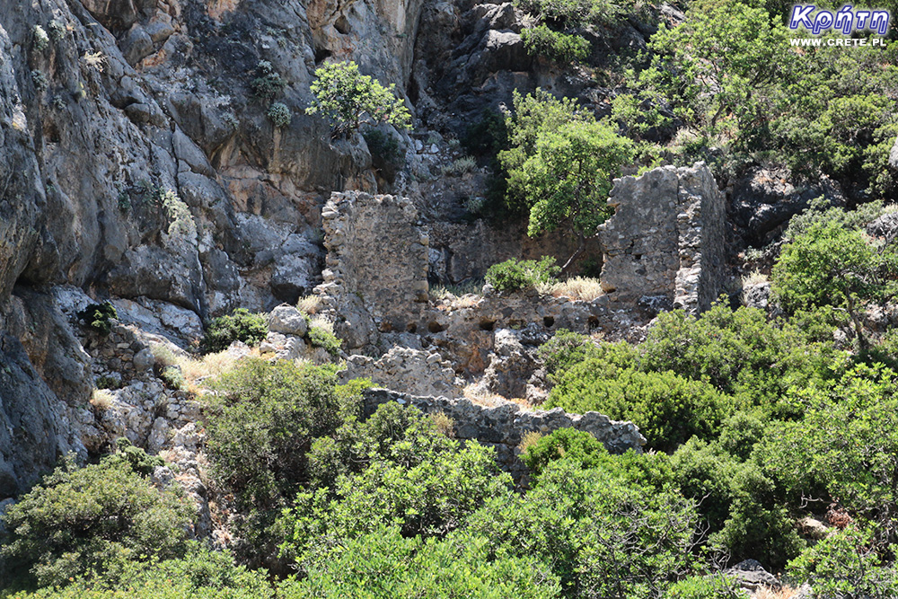
Most of the discovered ruins such as fragments of the theater and waterworks come from the Roman period. From this time, there are also 118 Roman tombs that cover the entire south and west of the gorge. From a distance, the burial chambers remind youinches single-bay small houses, because they were built on a rectangular plan with a convex vault.
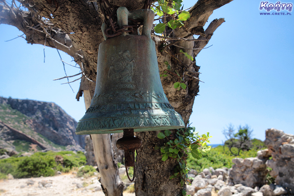
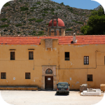
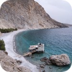
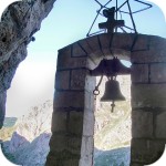
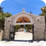
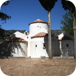
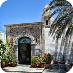
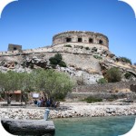
In the further part there are two Byzantine chapels of Agios Kirikos and Panagia. Dated to the 13th century, they were built on the ruins of early Christian churches. In the church of Agios Kirikos, on the 15th of June the Saint day is celebrated. Kirikosa, who was the youngest martyr of the Orthodox Church. On this evening, pilgrims come here by boat, who visit this church and participate in all-night celebrations.
What the future will show
Archaeological work in Lissos is still ongoing, so more than one treasure in the earth will be discovered in the future. One finds, among other things, the Diktinny Temple (Britomartis), which the researchers probably have evidence of.
In 1994, thanks to the acquired funds from the LEADER EU program, the excavated ruins were subjected to cleaning, maintenance and surface tests. Currently, much of the valley in which the ruins of Lissos are located has been expropriated by the Greek Ministry of Culture.
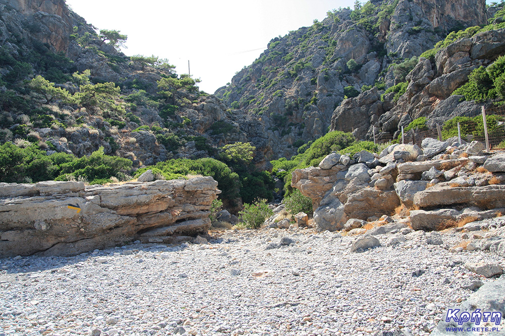
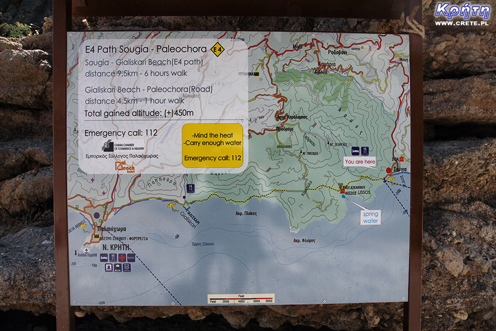
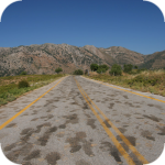
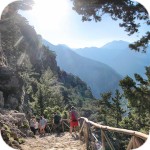
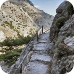
Trail E4 Sougia - Lissos
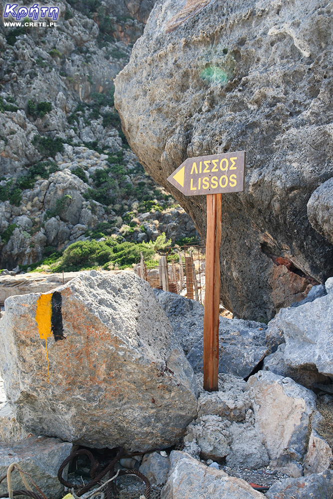
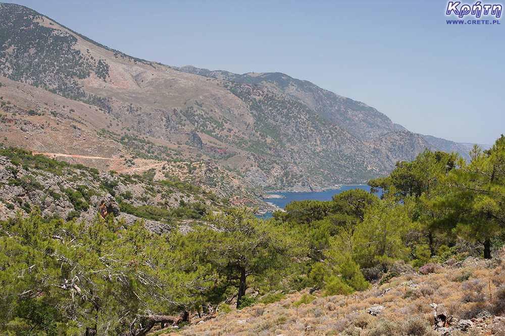
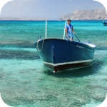
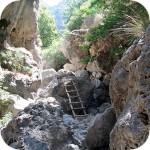
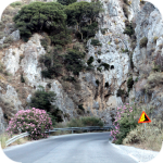
As we mentioned at the outset to reach Lissos, you can either rent a boat or walk along the E4 route from Paleochory (11.5 km) or from Sougia (3.5 km).
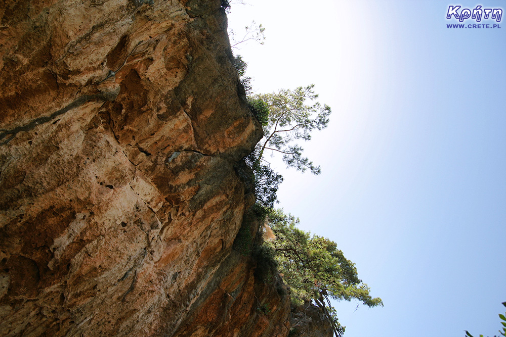
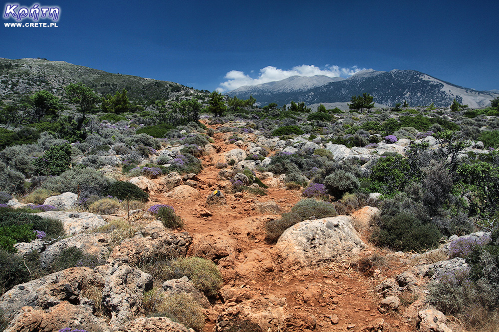
In spite of the relatively short distance between Sougia and Lissos, the passage of this route, especially in the hot summer, requires good preparation, because you can not replenish the water supply along the way. A few years ago, we found out for ourselves how ruthless the sun is here, when the water supply proves to be insufficient. Preparing to overcome this route, we have already prepared appropriately taking with us the appropriate amount of drinking.
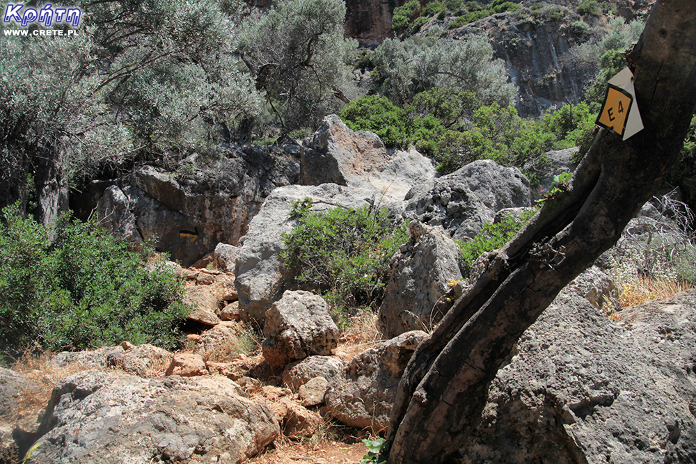
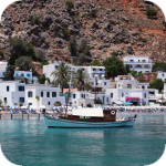
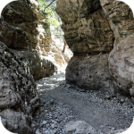
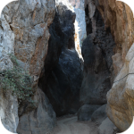
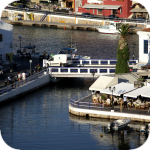
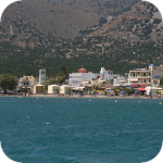
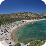
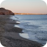
After leaving the car in the parking lot in Sougia, we went west along the main road running by the beach. After passing a small harbor, where there is a small stony beach, we spotted a hand-painted signpost with the inscription Lissos. This place signals the beginning of the route, which starts at the mouth of a small picturesque gorge.
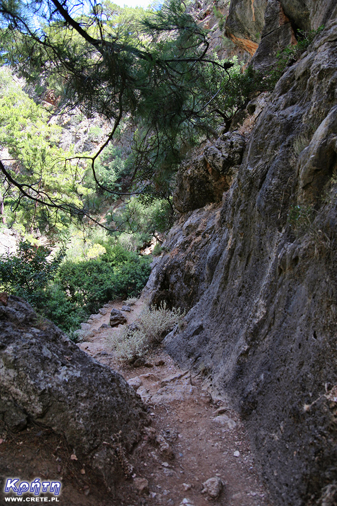
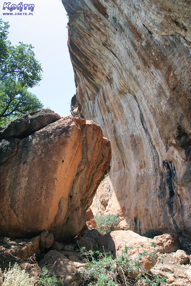
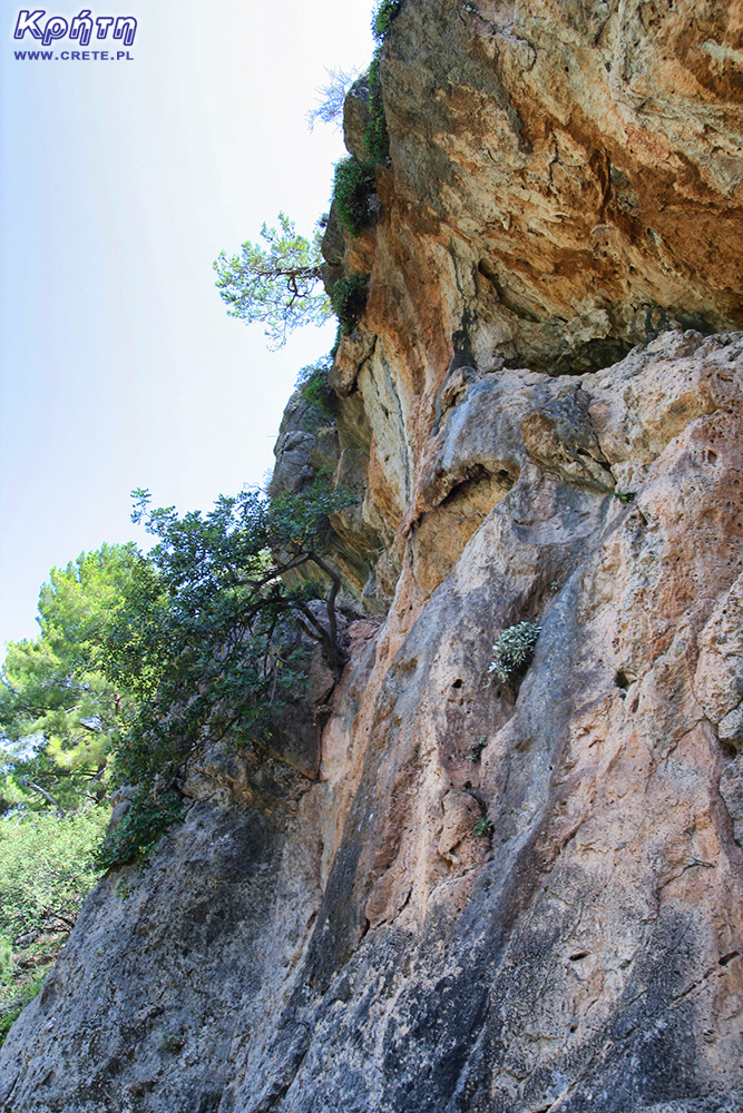
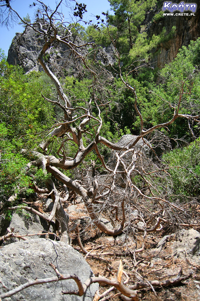
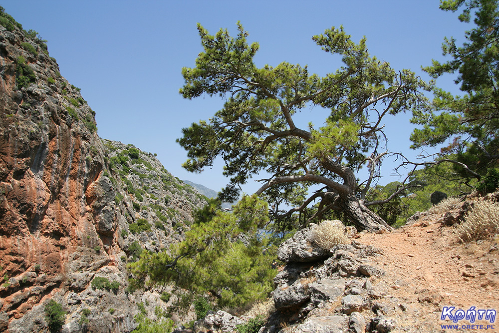
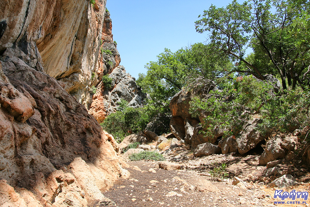
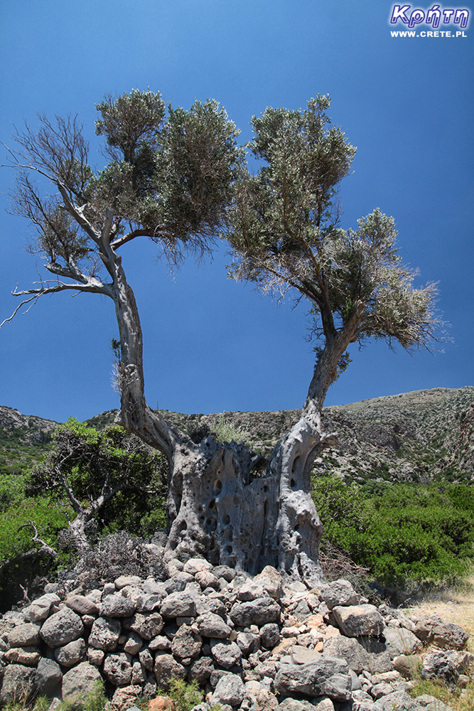
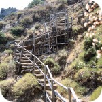
In this part of the route, get ready to overcome boulders and boughs that often cross the road. The further you get into the gorge, the more annoying the heat will become due to the still air. On the way, you will pass a picturesque hanging rock, in which the sheep and goats tend to hide. You can see the thick layer of their faeces accumulated in this place. After some time, the path leading along the bottom of the ravine begins to slowly climb to the western slope. It's a good place to make a stop. It is worth using the shadow cast by trees, especially that later it will not be at all.
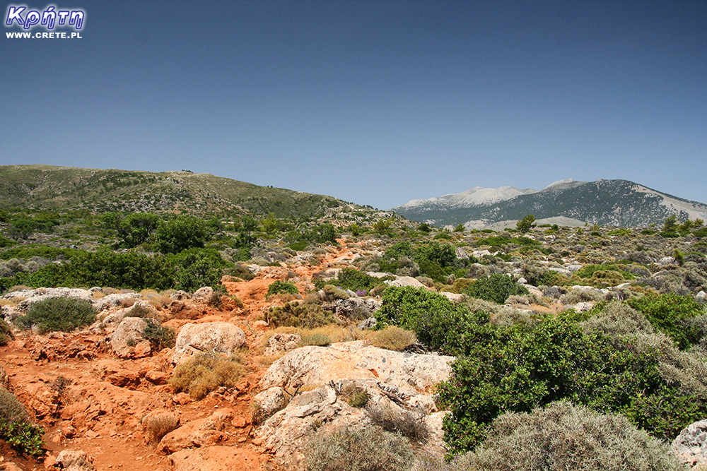
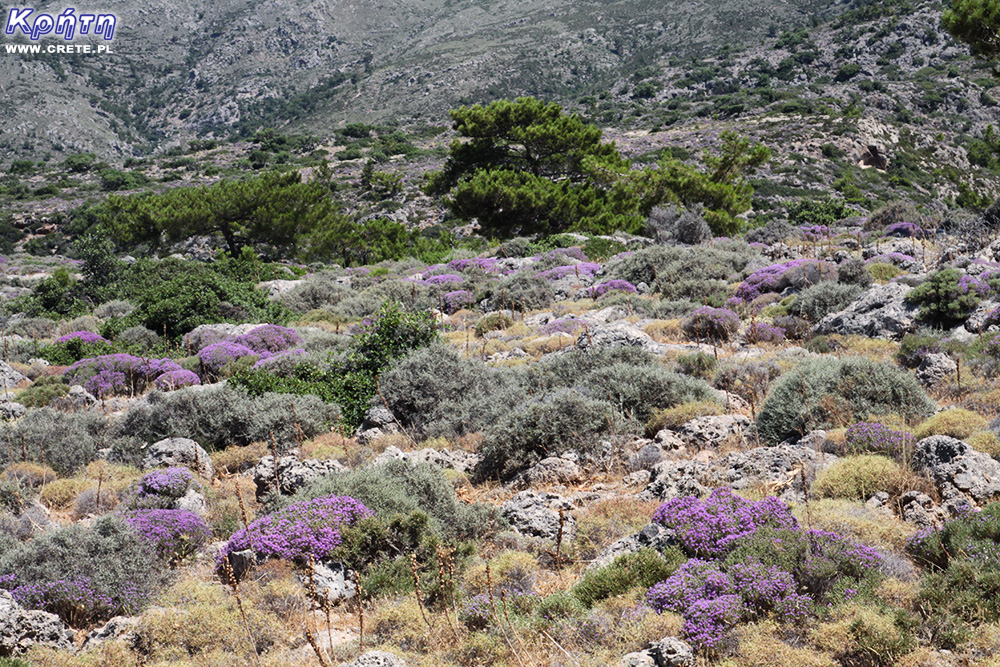
After entering the upper part of the trail we get to the Kandouni plateau, where we head further west. A poorly visible path winds between stones, dry prickly bushes and clumps of thyme. Trees here hardly grow, and the burning sun seems to suck every drop of sweat appearing on the skin.
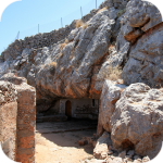
After about 800 meters of this "pan" we reach the edge of the slope. Here begins the part of the trail a bit harder to pass. It gets more steep and narrow and the path goes down sharply. We have the impression that the descent is much more difficult than the later way back, which passes in principle quite quickly. After a few dozen minutes, he finally goes down to the bottom of the valley and almost immediately goes to the ruins of the temple of Asklepios. They are fenced but to enter, just open the gate. The plaque attached to the gate informs you to close it behind you.
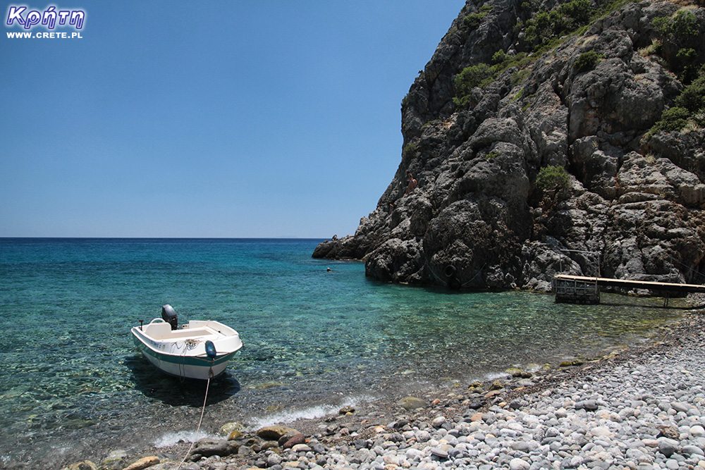
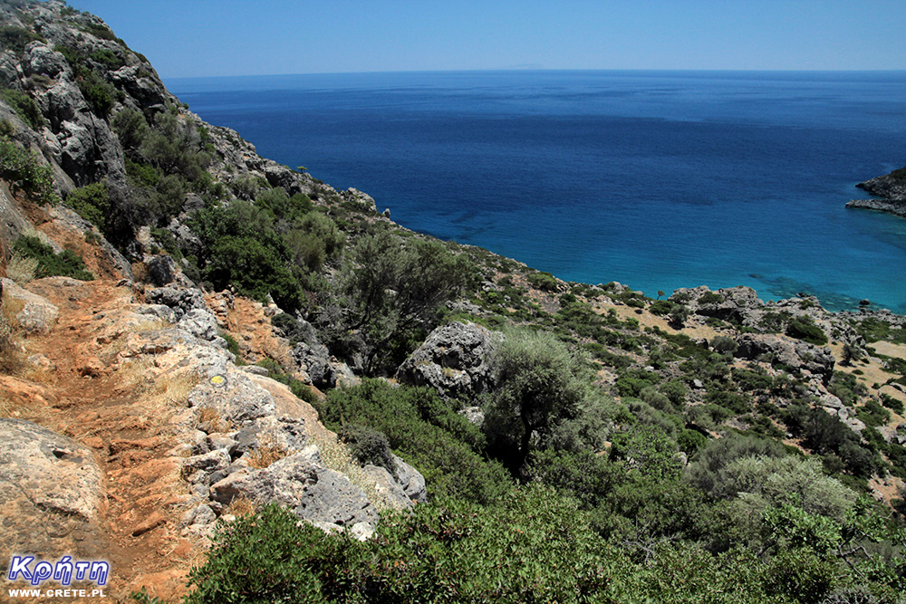
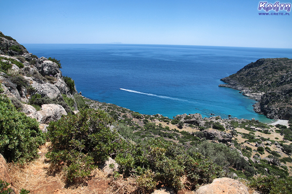
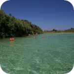
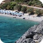
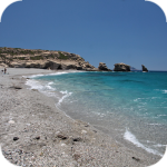
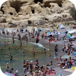
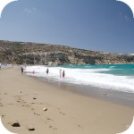
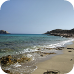
After looking at the wonderful mosaic, we returned to the trail. Although it may be too big a word, because the path is unspecified and has many branches. It's best to just go towards the coast. The beach marking the end of the trail and the bottom of the sea are stony.However, it does not bother the local family to play in the water. For a dozen or so minutes, we watch the kids jump into the sea from a steep slope descending towards the water.
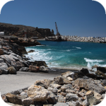
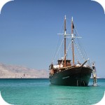
Of course, you can go on the way back using a boat (if you decide to deal with the captain earlier), but we decide to go the same way on foot. Climbing on a steep slope goes faster and faster than descent. This time the road through the plateau begins to slow down very quickly. The sun, which stands high in the sky at this time, is much more annoying. Finally, we reach the edge of the "pan" and after a short break in the shade of the trees, we begin to descend down the ravine. A walk along this piece of the route marked out in the forest is definitely the most pleasant part of it. In the end, we come to the bottom of the ravine, where there is still a long way to go. Choosing this trip in the summer especially on windless days, you have to get ready for a small "hell" in this part of the route. The heat pouring from the sky and ubiquitous heat is compounded by heated rocks and stone, which reflect the heat accumulated in their interior. With unhappy joy, we finally reach the exit of the ravine and enjoy the benefits of the sea on the beach at the mouth of the ravine. And this time, somehow we do not pay attention to the fact that it is stony ;-)
west
central
east
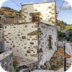
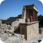
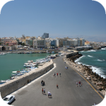
Interesting places on Crete
↤ click the appropriate part of the island to change the bottom map
W 2002 roku Falasarna zdobyła tytuł najlepszej plaży w Grecji. Wyróżnienie to nie jest bynajmniej przypadkowe, gdyż miejsce to jak na standardy Krety jest naprawdę unikalne.
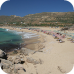
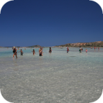
Elafonisi is a small island located at the end of the southwestern edge of Crete. A characteristic feature of Elafonisi is the shallow lagoon connecting it with Crete.
Elafonisi is a small island located at the end of the southwestern edge of Crete. A characteristic feature of Elafonisi is the shallow lagoon connecting it with Crete.
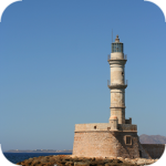
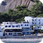
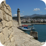
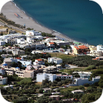
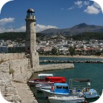
Chania (Χανιά) is the second largest (after Heraklion) city of Crete. The biggest advantage of Chania is the area of the Old Town and the beautiful Venetian Harbor.
Aptera is a city whose history dates back to at least a thousand years before our era. In the peak period, about 20,000 lived in it. people, of which only 1/5 were free people.
Chania (Χανιά) is the second largest (after Heraklion) city of Crete. The biggest advantage of Chania is the area of the Old Town and the beautiful Venetian Harbor.
Omalos is a perfect starting point for exploring the Samaria Gorge. Located over 1,100 m above sea level extends over an area of 25 km2. Its size corresponds more or less to the size of the Lasithi Plateau.
Located 47 km from the city of Chania, it is the only freshwater lake in Crete. Its area is about 580 thousand. sqm. and the maximum depth is about 45 meters
Omalos is a perfect starting point for exploring the Samaria Gorge. Located over 1,100 m above sea level extends over an area of 25 km2. Its size corresponds more or less to the size of the Lasithi Plateau.
The steel crossing, which in the central part is separated from the ground by nearly 150 m, is at the leading position of the places where the longest bungee jumps are made.
Chania (Χανιά) is the second largest (after Heraklion) city of Crete. The biggest advantage of Chania is the area of the Old Town and the beautiful Venetian Harbor.
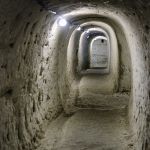
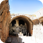
The cave is less than 1 km from Moni Gouvernetou Monastery. You will reach it using the pedestrian trail that has been marked out along the slope of the Avlaki Gorge.
Balos is one of Crete's flagship beaches if not all of Greece. We can assure you that the landscapes you see during your trip to Balos will remain with you for a very long time.
The Orthodox monastery of Agia Triada, located on the northern part of the Akrotiri peninsula, is one of the most beautiful and richest monasteries in Crete.
The Orthodox monastery of Agia Triada, located on the northern part of the Akrotiri peninsula, is one of the most beautiful and richest monasteries in Crete.
On the north-western coast of Crete, at the foot of the Gramovous peninsula, there are ruins of the ancient port of Korikos, later known as Falassarna.
Polyrinia was one of the most important city-states of western Crete during the Hellenistic and Roman periods. It was built amphitheater on a steep hill, rising to a height of 481 meters above sea level
The island of Gramvousa, or in fact Imeri Gramvousa (Ήμερη Γραμβούσα), is an inseparable point of a trip that combines a stay in the Balos Lagoon with visiting the remains of a fortress located on the top of the island of Imeri Gramovousa.
There is a beach in Crete that literally makes some people shiver. This place is Seitan Limania which can be translated as Satan's Ports or Cursed Ports.
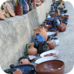
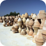
Dozens of craft workshops located in this small mountain village make Margarites one of the four main centers where traditional Cretan ceramics are made.
The date of the foundation of Moni Arkadiou (Arkadi) is not exactly known. According to tradition, the name of this church refers to the name of the Emperor Arkadiusz, who supposedly was to be its founder.
The date of the foundation of Moni Arkadiou (Arkadi) is not exactly known. According to tradition, the name of this church refers to the name of the Emperor Arkadiusz, who supposedly was to be its founder.
Rethymnon with around 40,000 inhabitants are the third largest city of Crete. This place was populated already in the Minoan period. Historically, the city was an important commercial center.
Skinaria is a small beach located along a small bay, whose outlet on both sides ends with a rocky coast. It is still a little-known place overlooked by mass tourism
Skinaria is a small beach located along a small bay, whose outlet on both sides ends with a rocky coast. It is still a little-known place overlooked by mass tourism
According to Greek mythology, Zeus hid (and perhaps even gave birth) in the Ida cave. This myth is the greatest asset of this cave, which is not as interesting and beautiful as the Dikte cave.
Tripiti is a small beach covered with a mixture of gray sand, gravel and stones. Despite the fact that the beach is unorganized and has a semi-natural appearance, one small tavern works here.
Tripiti is a small beach covered with a mixture of gray sand, gravel and stones. Despite the fact that the beach is unorganized and has a semi-natural appearance, one small tavern works here.
Tripiti is a small beach covered with a mixture of gray sand, gravel and stones. Despite the fact that the beach is unorganized and has a semi-natural appearance, one small tavern works here.
Plakias is a perfect place for people who like to spend time hiking. In the area of the town and the surrounding area, there are several hiking trails that lead to interesting beaches.
Currently, the lower monastery is still not open to the public and is not used by the monks. The buildings of the upper monastery have undergone partial renovation and are the main seat of the Preveli monastery.
Currently, the lower monastery is still not open to the public and is not used by the monks. The buildings of the upper monastery have undergone partial renovation and are the main seat of the Preveli monastery.
Currently, the lower monastery is still not open to the public and is not used by the monks. The buildings of the upper monastery have undergone partial renovation and are the main seat of the Preveli monastery.
The Kourtaliotiko Gorge, also known as the Asomatos Gorge, is perhaps one of the most spectacular natural attractions available in the central part of Crete.
Agia Triada is a small Minoan archaeological site in the south of Crete, located near Timpaki, located on the western slope of the hill about 40 meters above sea level.
This fortress is a perfect example of Crete's multiculturalism. Located today in Greek hands, it was built by the Venetians, but is called a name taken from the Turkish language.
Rouvas Gorge is one of the most interesting places in this part of Crete. The interesting trail leads in a perfect way to the changing appearance of this gorge.
Matala is one of the most popular towns not only of the southern coast but also of the whole of Crete. In the 1960s and 1970s, this small fishing village was a mecca for hippies.
The Odigitrias Monastery is one of the most famous monasteries of southern Crete. Unfortunately, in terms of popularity, he is far from other Cretan monasteries.
In addition to the famous grand palaces on the island in the Minoan period, a number of smaller residences were created. One of the most important examples is the Vathipetro discovered about 5 km north of Archanes, on the southeastern slope of Mount Juchtas in the central part of Crete.
When traveling around Crete, it is not difficult to pay attention to the fact that most of the beaches there are relatively small and short. For this reason, people who are used to our national Baltic standards, where the sandy coast stretches for kilometers, may experience a special disappointment. However, fortunately, nothing is lost, because Crete in its rich arsenal of various beaches can boast of those that allow for long walks along the coast. One of them, our favorite is the Kommos beach located in the south of the central part of the island.
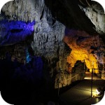
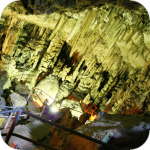
Although there are countless caves in Crete, only a few can be visited. Sfendoni is the largest cave open to the public. content comes from: http://www.crete.pl www.CRETE.pl
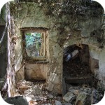
Only a few kilometers separate the bustling city of Rethymno from Mili, a village abandoned by its inhabitants. This place is also known as the village hidden in the gorge.
Information about one of the more known tourist cities of Crete, or about Malia. Description of attractions located in the city of Malia and a description of the specificity of this town.
The Lasithi Plateau is located about 70 kilometers from the capital of Crete - Heraklion. The average height at which the terrain of this plateau is located is 840 m above sea level.
One of the tourist attractions eagerly visited by people spending their holidays in Crete is the Dikte (Psychro) cave. The main factors that attract people to this cave are a rich and varied dripstone robe and a close connection with mythology.
Among the olive groves in the place called Logari, which is less than a kilometer from the village of Kritsa, there is a small Byzantine church of Panagia Kera from the 13th-14th centuries.
Stalida is located directly along the coast and is one of the most famous tourist destinations in Crete, which definitely comes alive with the advent of the tourist season
Most people crossing the route between Agios Nikolaos and Ierapetra will definitely notice the large crack which is marked by the mountain located east of this road. This majestic geological creation called Ha was probably created as a result of an earthquake.
Xerokambos is a small settlement in which you will find literally several taverns, and most of the buildings are single-storey and one-story houses. The big advantage of this beach is a gentle sandy descent to the sea.
Agios Nikolaos (Άγιος Νικόλαος) is a small town with less than 20,000 inhabitants. permanent residents (according to statistical data from 2001). This city is the capital of the Lasithi nomos.
Although Elounda seems to be a sleepy fishing town to this day, however, appearances should not fool you, because this town and its surroundings can boast of probably the largest number of the best hotels.
Although Elounda seems to be a sleepy fishing town to this day, however, appearances should not fool you, because this town and its surroundings can boast of probably the largest number of the best hotels.
Stalida is located directly along the coast and is one of the most famous tourist destinations in Crete, which definitely comes alive with the advent of the tourist season
Zakros is the fourth-largest Minoan palace in Crete in importance and size. This latest found, built on the east coast of the island is located in the village of Káto Zákros.
Zakros is the fourth-largest Minoan palace in Crete in importance and size. This latest found, built on the east coast of the island is located in the village of Káto Zákros.
The first palace was built around 1900 BC. in the place where there was a quite impressive settlement whose remains were later transformed into the central part of the city.
The ruins of the ancient city of Itanos are located at the eastern tip of Crete, less than 3 kilometers north of the famous palm beach of Vai. Although there are also nice beaches at Itanos, unlike its well-known neighbor, this place does not attract crowds. There are either accidental stray tourists or excavation enthusiasts here.
Less than 10,000 population of Sitia makes the city the smallest in Crete. Some even go a step further and say perversely that it is rather the largest village of Crete.
Napoleon's house is one of the few typically tourist attractions in Ierapetra. About what could have happened here in the summer of 1798 and possibly how much in this legend is the truth we write in the article on the page below.
Moni Kapsa Monastery is one of the most interesting monasteries in Crete. Its massive buildings were erected on rocky, gray slopes surrounding the nearby Pervolakia Gorge.
Mam pytanie. W mojej sytuacji pieszo nie wchodzi w rachube. Gdybym doplynela lodka z Sougii czy ruiny sa oddalone od wybrzeza? Czy trzeba sie wspinac po skalach? Za kilka dni bede na Krecie i wybieram sie do Sougii. Czy ew łodki do Lissos czekaja w porcie czy trzeba zamawiac?
CRETE - Kreta
2016-06-02 07:40:22
komentarz z
Ruiny świątyni są nieco oddalone od wybrzeża ale idzie się po płaskim terenie. Pozostałości grobów są rozsiane raczej na zboczach więc dostęp tam jest dość utrudniony. Natomiast kaplica Agios Kirikos jest tuż przy plaży. Zaś co do łódki to w wielu miejscach w Sougii są rozwieszone ogłoszenia z nr telefonu do kapitana. Ewentualnie można popytać też w tawernach.
Zofia Sokołowska
2016-06-02 08:58:19
komentarz z
Dzięki
Zofia Sokołowska
2016-06-14 18:49:41
komentarz z
Byłam, płynęłam z kapitanem George do Lissos motorowka. Po prostu był w porcie.W Lissos byłam w świątyni Asklepiosa, kaplicy.Grobowce widziałam. W drodze powrotnej kapitan pokazał ogromną grote w skałach w pobliżu. A w Sougii jadłam w tawernie przepyszna rybkę. Droga z Chania przez góry tez była ekscytująca.
CRETE - Kreta
2016-06-14 18:59:37
komentarz z
Super! Bardzo się cieszymy że poznałaś to miejsce :)
1
gość PiotrWie
2019-02-23 22:18:45
Trasa z Sougii do Lissos to 45 min + zdjęcia i podziwianie krajobrazu - w zależności od potrzeb dla wprawnego piechura - przeszliśmy ją w sumie czterokrotnie, w tym dwukrotnie z plecakami na dwutygodniowy pobyt plus jedzenie i woda na dwa dni -25 i 15 kg, ma długość niecałe 3,5 km i przewyższenie ok 150 m ( profil trasy - https://pl.wikiloc.com/szlaki-wycieczki-piesze/sougia-lissos-25255614) W 2017 wracając spieszyliśmy się i przeszliśmy w 40 min jednym ciągiem - nawet bez postoju na picie które mieliśmy ale nie było potrzebne - tak więc osobom choć trochę chodzącym polecam - prawie każdy przejdzie bez problemu.
gość Marta
2020-05-28 02:50:56
Lissos tylko pieszo polecam
Byłam w Lissos pieszo z Sugi w lipcu zeszłego roku. Półtoragodzinny treking zapiera dech ☺
Wypełnij poniższy formularz aby dodać komentarz
lub kliknij w poniższy link aby skorzystać z możliwosci komentowania przez facebooka: https://www.facebook.com/crete.poland/posts/10153635750937551
Tylissos is one of the few places in Crete that has kept its name since ancient times. Between 1200 and 1000 BC, many settlements were abandoned by their inhabitants, who founded new villages in more inaccessible areas. Tylissos is an exception because it was inhabited all the time, thanks to which cultural continuity was maintained and the development of the religious center took place.
11 km from the city of Sitia, near the modern village of Chamaizi, there is a small archaeological site. At the top of a cone-shaped hill called Souvloto Mouri, the remains of an unusual building with a unique oval shape were discovered. Despite its small size, it is one of the most important discoveries that comes from the Central Minoan period. So far, it is the only oval building from Crete in this period.
Just over 2 km from Palekastro, next to Chiona beach, there is a large archaeological site called Roussolakos, which is worth visiting in this region of Crete.
gość PiotrWie Wczoraj zaczęło przybywać ludzi na wyspie, dziś ( czwartek) przybyło wyraźnie więcej - przyjechali Grecy na święta. Zobaczymy na jak długo.
gość PiotrWie My lecieliśmy ( co prawda 10 kwietnia, więc 9 dni przed Wielkanocą ) z Aten na Paros i w samolocie było zdecydowanie poniżej połowy miejsc zajęte. Na dzień dzisiejszy jest bardzo mało ludzi - co nas bardzo cieszy. Ponieważ planujemy pozostać na Cykladach do 4 czerwca zobaczymy kiedy ilość turystów zacznie narastać.
gość zecia Moussaka to greckie danie, które zawsze mnie urzeka swoim smakiem. Robię ją z bakłażanem, mieloną wołowiną, ziemniakami i kremowym beszamelem. Bakłażana smażę na oliwie, mięso doprawiam cynamonem i pomidorami – aromat roznosi się po kuchni. Układam warstwy i zapiekam, aż wierzch jest złocisty – wygląda jak z obrazka. Dla nas wrzucam odrobinę ostrej papryki – polski sznyt dla wyrazistości. (...)

 As we mentioned at the outset to reach Lissos, you can either rent a boat or walk along the E4 route from Paleochory (11.5 km) or from Sougia (3.5 km).
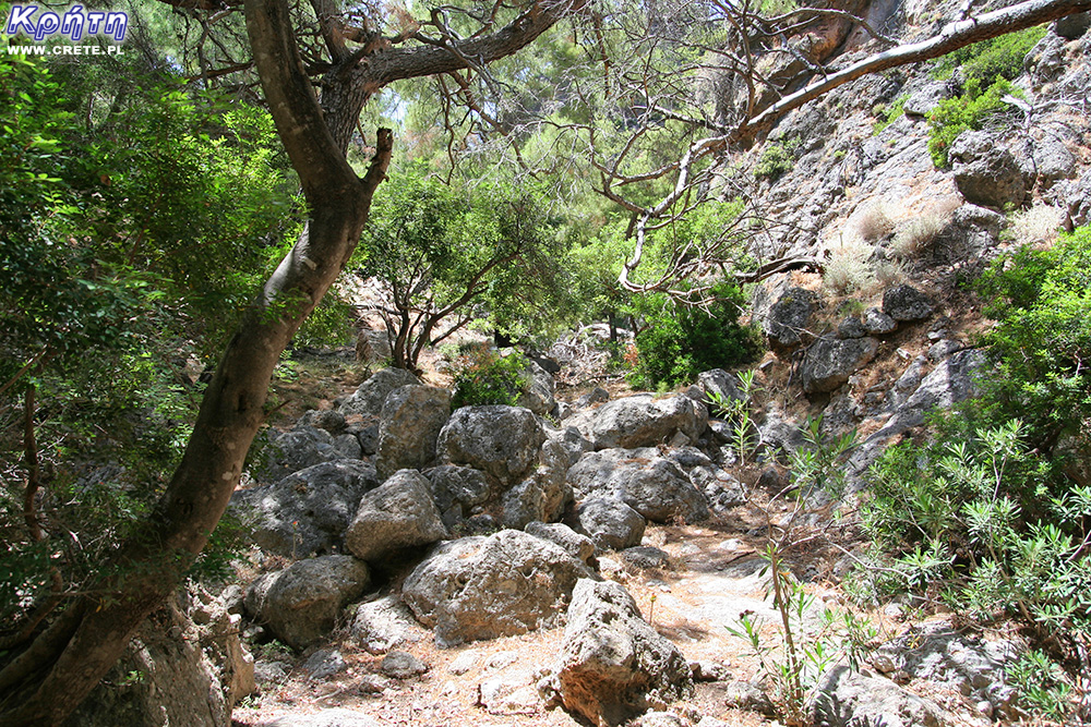


Komentarze
komentarz z
Mam pytanie. W mojej sytuacji pieszo nie wchodzi w rachube. Gdybym doplynela lodka z Sougii czy ruiny sa oddalone od wybrzeza? Czy trzeba sie wspinac po skalach? Za kilka dni bede na Krecie i wybieram sie do Sougii. Czy ew łodki do Lissos czekaja w porcie czy trzeba zamawiac?
komentarz z
Ruiny świątyni są nieco oddalone od wybrzeża ale idzie się po płaskim terenie. Pozostałości grobów są rozsiane raczej na zboczach więc dostęp tam jest dość utrudniony. Natomiast kaplica Agios Kirikos jest tuż przy plaży. Zaś co do łódki to w wielu miejscach w Sougii są rozwieszone ogłoszenia z nr telefonu do kapitana. Ewentualnie można popytać też w tawernach.
komentarz z
Dzięki
komentarz z
Byłam, płynęłam z kapitanem George do Lissos motorowka. Po prostu był w porcie.W Lissos byłam w świątyni Asklepiosa, kaplicy.Grobowce widziałam. W drodze powrotnej kapitan pokazał ogromną grote w skałach w pobliżu. A w Sougii jadłam w tawernie przepyszna rybkę. Droga z Chania przez góry tez była ekscytująca.
komentarz z
Super! Bardzo się cieszymy że poznałaś to miejsce :)
Trasa z Sougii do Lissos to 45 min + zdjęcia i podziwianie krajobrazu - w zależności od potrzeb dla wprawnego piechura - przeszliśmy ją w sumie czterokrotnie, w tym dwukrotnie z plecakami na dwutygodniowy pobyt plus jedzenie i woda na dwa dni -25 i 15 kg, ma długość niecałe 3,5 km i przewyższenie ok 150 m ( profil trasy - https://pl.wikiloc.com/szlaki-wycieczki-piesze/sougia-lissos-25255614) W 2017 wracając spieszyliśmy się i przeszliśmy w 40 min jednym ciągiem - nawet bez postoju na picie które mieliśmy ale nie było potrzebne - tak więc osobom choć trochę chodzącym polecam - prawie każdy przejdzie bez problemu.
Lissos tylko pieszo polecam
Byłam w Lissos pieszo z Sugi w lipcu zeszłego roku. Półtoragodzinny treking zapiera dech ☺
Wypełnij poniższy formularz aby dodać komentarz
lub kliknij w poniższy link aby skorzystać z możliwosci komentowania przez facebooka:
https://www.facebook.com/crete.poland/posts/10153635750937551